Hiking is by far one of the best ways to experience the breathtaking natural beauty of the Sierra Nevada mountains in North Lake Tahoe. Each trail, no matter how gentle or steep, offers a unique adventure through stunning landscapes, scenic vistas, lush forests, rushing waterfalls and crystal-clear alpine lakes. Whether you’re a seasoned hiker, explorer or wanderer, North Lake Tahoe has a trail for you.

BEFORE YOU GO: During late Spring and early Summer some higher elevation trails may be impacted by snow pack. Mountain weather can also change quickly. Always check conditions before heading out. Next, get acclimated with easy to moderate hikes before heading to higher altitude. Always, bring plenty of water, snacks, sunscreen, a hat and outer layer. Wear appropriate footwear with ankle support and tread. Expect wet rock, which can be slippery. Hike with a friend or share your route. Refer to an app like All Trails for more information about the terrain and conditions. Map and download prior to your hike for best navigation on trail. Have fun!
Here are some of our favorite hiking adventures for this Summer:
Family-Friendly, North Tahoe Regional Park Trails – Hike from your front door at Mourelatos Lakeshore Resort to some beautiful, easy and very accessible trails at North Tahoe Regional Park—just behind the resort. Try the Pine Drop trail, a beautiful 2.6-mile out-and-back, paved trail through the national forest that ends at our North Tahoe outdoor recreation center. Dogs are welcome on a leash.

The Eagle Falls Trail. Just south of Emerald Bay State Park, you’ll find a breathtaking short but steep hike with large granite peaks, towering mountains and lush vegetation leading you to Eagle Falls, a stunning, cascading waterfall not to miss. Approximately 1.5 miles round-trip, the trail is considered moderate but there are a few steep sections of stone stairs and rocky terrain. For a longer, more challenging granite-etched hike, keep following the trail up to picturesque Eagle Lake (requires easy to get Desolation Wilderness permit at trailhead). Well worth every step! Parking fills up quickly. Get an early start.
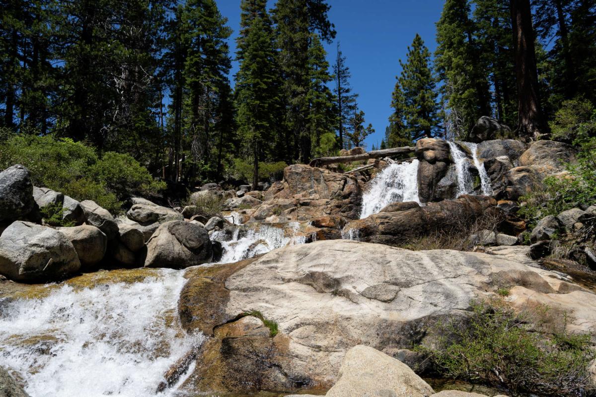
Shirley Canyon Trail. This hike has it all! A popular and dog-friendly trail spilling with stunning views of the towering granite peaks, surrounding mountains, wild flowers galore, dozens of amazing waterfalls and a serene mountain alpine lake for a picnic or swim. The out-and-back trail (or find the operating schedule for a one-way, free tram ride down from High Camp) is approximately 4 miles and considered moderate to challenging, with many steep sections and rocky terrain as it twists up to 8,200 feet at High Camp. The trail will most likely have some snow on it through June and July this season, so be prepared. Note that the trail markers are not always visible. Use a trail app to ensure your route. The trail head starts at Palisades Tahoe, at the end of Squaw Peak Road and follows a picturesque creek through a lush canyon of roaring falls with giant granite slabs and picturesque pools.
Mount Rose: This iconic peak offers stunning views of the surrounding landscape, including Lake Tahoe, Reno area and the Sierra Nevada Mountains. The 10 mile, out-and-back trail begins close to the summit on Mount Rose Hwy. Exposed at higher altitude and challenging, the trail includes steep inclines and rocky terrain towards its peak of 10,875 feet. The views are well worth the effort and about mid-way you have a beautiful resting point at some roaring falls before the big ascent. Start early as parking fills up.
Donner Summit Canyon Trail. This easy-to-moderate 3.5 round-trip hike follows a beautiful creek through a rugged canyon near Donner Summit. It offers stunning views of the surrounding mountains and is popular with families. It does, however, have some steep sections, switchbacks and rocky terrain. The trailhead is located off of Old Highway 40, just east of the town of Soda Springs. As you make your way up the canyon, you’ll pass several beautiful waterfalls and enjoy stunning views of the surrounding mountains. Along the way, you’ll also see several historical landmarks, including the old train tunnels and the China Wall from the late 1800s.
Tahoe Rim Trail. For those seeking the ultimate trekking adventure, check out our world-famous Tahoe Rim Trail. Don’t let this 165-mile loop around Lake Tahoe keep you off the trail. There are dozens of trailheads and routes, making this trail system perfect for most hikes with a little or a lot of time. Above all it offers unparalleled views of the Lake Tahoe below and the rugged peaks above.
Mt. Tallac. One of the most challenging hikes at Lake Tahoe, Mount Tallac trail takes you to the summit of the tallest mountain in the Tahoe basin (9,735’). While it takes effort, the views from the top are well worth it. This hike is approximately 10 miles roundtrip, with an elevation change of 3,255 feet. Note: a hiking permit is required for this trail, and can be obtained at the trailhead. Snow will be in sections late in the season. Hiking poles recommended.
Wildflower Hikes. North Lake Tahoe is a fantastic destination for exploring the diverse flora and fauna of the region. You’ll visit our region’s rugged slopes and alpine meadows, where bees, butterflies, and birds engage in natural cycles of pollination. Of course, timing and elevation are everything when it comes to wildflowers. From wildflower exploration to forested and interpretive nature hikes and wildlife sightings, the diversity is amazing and ready to be respected, appreciated, and explored. Due to the heavy snow pack from this past winter, wildflower season this year is going to be fantastic.
It is expected that the wildflower peak will be in the middle of July at low-to-mid elevations and at the beginning of August at mid-to-high elevations. One of the best places to see them around Lake Tahoe will be at Carson Pass which is south of the Lake Tahoe basin. Please don’t pick. Just enjoy the moments we have each year with some of natures most delectable and delightful beauty.